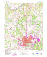
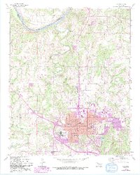
1958 Map of Ada
USGS Topo · Published 1993About this map
Ada serves as the focal point of this 1958 landscape, anchored by institutions like East Central University and the Ada Municipal Airport. The map documents the mid-century expansion of the city into the surrounding Pontotoc County countryside, marked by a dense network of civic and educational sites including Willard Sch, Washington Sch, and Middle Sch. To the north, the Canadian River forms a significant boundary, with the historic Old Indian Bdy and the Seminole Co line cutting through the river valley.
Find a feature on this map
45 named features on this map. Tap any name to fly to it.
Don’t see what you’re looking for? This feature index may not catch every label — zoom into the map to look around manually.
Map Details
Editions of this 1958 Ada Map
6 editions found
Other maps of this area

1901 · Stonewall
USGS Topo · 1:125,000

1957 · Stonewall
USGS Topo · 1:24,000

1957 · Ardmore
USGS Topo · 1:250,000

1958 · Sasakwa
USGS Topo · 1:24,000

1958 · Francis
USGS Topo · 1:24,000

1958 · Ada
USGS Topo · 1:24,000

1958 · Vamoosa
USGS Topo · 1:24,000

1958 · Konawa
USGS Topo · 1:24,000

1963 · Ardmore
USGS Topo · 1:250,000

1967 · Ahloso
USGS Topo · 1:24,000