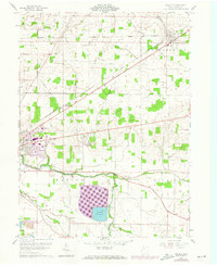
1960 Map of Arcadia
USGS Topo · Published 1973About this map
Agricultural lands and industrial infrastructure define the Hancock County landscape in this survey, which captures the eastern edge of Findlay and the village of Arcadia. The terrain is marked by a complex network of drainage and water management, centered on the significant Findlay Reservoir and the winding course of the Blanchard River. Small rural hubs and family lineages are anchored by community landmarks such as Salem Ch, Bethlehem Ch, and Mt Zion Ch, along with numerous local burial grounds including High Bank Cem and Hamlin Cem. The Norfolk and Western railroad corridors cut diagonally across the townships of Allen, Cass, and Washington, illustrating the region's reliance on rail transport for its farming and emerging industrial sectors. Revisions from the early 1970s, noted in purple, highlight the ongoing expansion of the suburban fringe near the city center.
Find a feature on this map
28 named features on this map. Tap any name to fly to it.
Don’t see what you’re looking for? This feature index may not catch every label — zoom into the map to look around manually.
Map Details
Editions of this 1960 Arcadia Map
Other maps of this area

1901 · Fostoria
USGS Topo · 1:62,500

1903 · Fostoria
USGS Topo · 1:62,500

1903 · Findlay
USGS Topo · 1:62,500

1905 · Arlington
USGS Topo · 1:62,500

1907 · Arlington
USGS Topo · 1:24,000

1907 · Upper Sandusky
USGS Topo · 1:62,500

1950 · Marion
USGS Topo · 1:250,000

1956 · Toledo
USGS Topo · 1:250,000

1960 · Bloomdale
USGS Topo · 1:24,000

1960 · Alvada
USGS Topo · 1:24,000