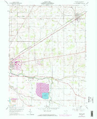
1960 Map of Arcadia
USGS Topo · Published 1973About this map
The Blanchard River and its accompanying waterway, The Outlet, define the lower third of this Hancock County landscape during a period of significant infrastructure expansion. The massive Findlay Reservoir dominates the southern townships of Marion and Biglick, featuring a complex system of dikes, a Pumping Sta, and an Aqueduct. This 1960s-era topography, updated with early 1970s revisions, illustrates the industrial and residential growth near the eastern edge of Findlay, including the development of a Trailer Park and a nearby Sewage Disposal plant.
Find a feature on this map
31 named features on this map. Tap any name to fly to it.
Don’t see what you’re looking for? This feature index may not catch every label — zoom into the map to look around manually.
Map Details
Editions of this 1960 Arcadia Map
Other maps of this area

1901 · Fostoria
USGS Topo · 1:62,500

1903 · Fostoria
USGS Topo · 1:62,500

1903 · Findlay
USGS Topo · 1:62,500

1905 · Arlington
USGS Topo · 1:62,500

1907 · Arlington
USGS Topo · 1:24,000

1907 · Upper Sandusky
USGS Topo · 1:62,500

1950 · Marion
USGS Topo · 1:250,000

1956 · Toledo
USGS Topo · 1:250,000

1960 · Bloomdale
USGS Topo · 1:24,000

1960 · Alvada
USGS Topo · 1:24,000