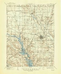
1908 Map of Ashland
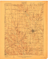
USGS Topo · Published 1948About this map
Ashland serves as the industrial and transportation hub of this north-central Ohio region, where the Erie Railroad and Southern Railroad converge to support the local economy. The landscape is defined by the headwaters of the Mohican River, specifically the Jerome Fork and Black Fork, which wind through a patchwork of agricultural townships including Milton and Montgomery. A notable detail in this edition is the inclusion of flooded areas, which illustrate the hydrological challenges of the era near Savannah Lakes and along the various creek basins.
Find a feature on this map
63 named features on this map. Tap any name to fly to it.
Don’t see what you’re looking for? This feature index may not catch every label — zoom into the map to look around manually.
Map Details
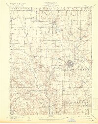
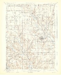
Editions of this 1908 Ashland Map
4 editions found
Historical Maps of Mansfield Through Time
1 maps found
Featured Locations
- Ashland, OH
- Mansfield, OH
- Hayesville, Vermillion Township
- Bailey Lakes, Clear Creek Township
- Savannah, Clear Creek Township