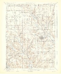
1908 Map of Ashland
USGS Topo · Published 1929About this map
Ashland serves as the industrial and transport hub for this region at the turn of the century, anchored by the intersecting lines of the Erie Railroad and the Lorain Ashland and Southern. The landscape is a patchwork of rural townships like Milton and Clear Creek, where the drainage of the Black Fork and Jerome Fork of the Mohican River dictated the placement of early settlements.
Find a feature on this map
64 named features on this map. Tap any name to fly to it.
Don’t see what you’re looking for? This feature index may not catch every label — zoom into the map to look around manually.
Map Details
Editions of this 1908 Ashland Map
4 editions found
Other maps of this area

1904 · Wellington
USGS Topo · 1:62,500

1906 · Wellington
USGS Topo · 1:62,500

1906 · West Salem
USGS Topo · 1:62,500

1908 · Ashland
USGS Topo · 1:62,500

1908 · West Salem
USGS Topo · 1:62,500

1908 · New London
USGS Topo · 1:62,500

1912 · Loudonville
USGS Topo · 1:62,500

1912 · Perrysville
USGS Topo · 1:62,500

1914 · Loudonville
USGS Topo · 1:62,500

1915 · Norwalk
USGS Topo · 1:62,500