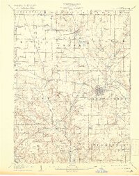
1908 Map of Ashland
USGS Topo · Published 1918About this map
Ashland serves as the central hub of this northern Ohio landscape, where the Erie Railroad and the Lorain Ashland and Southern line intersect near Ashland Creek. The map documents a dense network of rural infrastructure at the start of the twentieth century, particularly the numerous township schools and churches that anchored local life, such as Anderson School and Dickey Church.
Find a feature on this map
58 named features on this map. Tap any name to fly to it.
Don’t see what you’re looking for? This feature index may not catch every label — zoom into the map to look around manually.
Map Details
Editions of this 1908 Ashland Map
4 editions found
Other maps of this area

1904 · Wellington
USGS Topo · 1:62,500

1906 · Wellington
USGS Topo · 1:62,500

1906 · West Salem
USGS Topo · 1:62,500

1908 · Ashland
USGS Topo · 1:62,500

1908 · West Salem
USGS Topo · 1:62,500

1908 · New London
USGS Topo · 1:62,500

1912 · Loudonville
USGS Topo · 1:62,500

1912 · Perrysville
USGS Topo · 1:62,500

1914 · Loudonville
USGS Topo · 1:62,500

1915 · Norwalk
USGS Topo · 1:62,500