
2023 Map of Bakers Mills
USGS Topo · Published 2023About this map
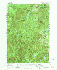
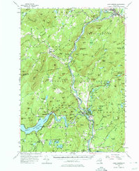
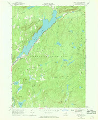
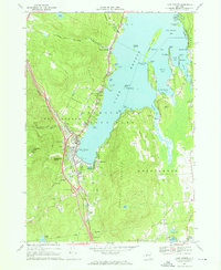
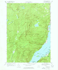
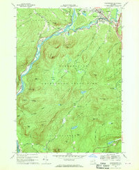
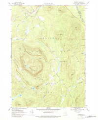
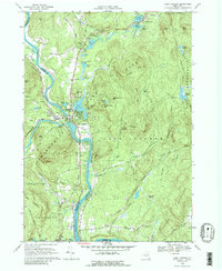
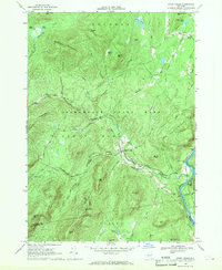
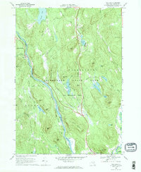
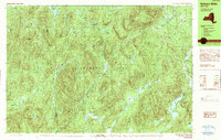
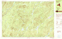
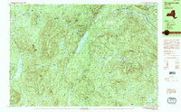
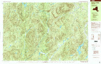
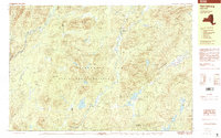
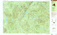
Bakers Mills serves as the primary settlement in this part of Warren County, where the terrain is defined by the high peaks of the Adirondacks and the drainage of the East Branch Sacandaga River. The landscape is a network of named heights, including Eleventh Mountain, Barker Mountain, and Kettle Mountain, interspersed with secluded water bodies like Eagle Pond and the multi-lobed Fish Ponds. The map records a distinct recreational and local-history geography, where primitive paths like the Oregon Trl and Lizard Pond Trl connect scattered points of interest such as the small settlement of Oregon and Gillingham Knoll. Down in the valleys, the rural character is preserved along Bartman School Rd and Dunkley Rd, tracing the early routes used by local families and industry before modern development changed the surrounding townships.
Find a feature on this map
56 named features on this map. Tap any name to fly to it.
Don’t see what you’re looking for? This feature index may not catch every label — zoom into the map to look around manually.
Map Details
Editions of this 2023 Bakers Mills Map
This is the sole edition of this map. No revisions or reprints were ever made.
Historical Maps of Oregon Through Time
36 maps found
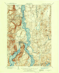
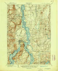
1894 Ticonderoga
Warren County, NY
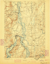
1896 Ticonderoga
Warren County, NY

1897 Bolton
Warren County, NY
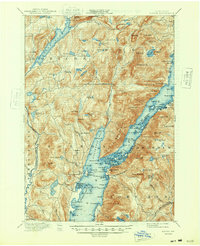
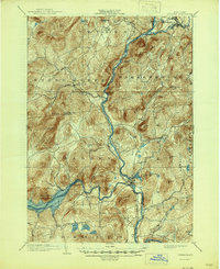
1898 Thirteenth Lake
Warren County, NY
1900 Bolton
Warren County, NY
1902 Ticonderoga
Warren County, NY
1903 Luzerne
Warren County, NY
1954 Thirteenth Lake
Warren County, NY
1955 Lake Luzerne
Warren County, NY
1966 Brant Lake
Warren County, NY
1966 Lake George
Warren County, NY
1966 Silver Bay
Warren County, NY
1966 Warrensburg
Warren County, NY
1968 Johnsburg
Warren County, NY
1968 Lake Luzerne
Warren County, NY
1968 Stony Creek
Warren County, NY
1968 The Glen
Warren County, NY
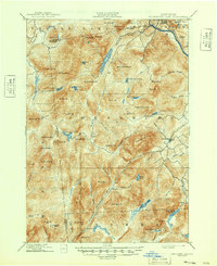
1990 Bakers Mills
Warren County, NY
1990 Harrisburg
Warren County, NY
1990 Thirteenth Lake
Warren County, NY
1997 Bakers Mills
Warren County, NY
1997 Harrisburg
Warren County, NY
1997 Thirteenth Lake
Warren County, NY
2023 Bakers Mills
Warren County, NY

2023 Brant Lake
Warren County, NY

2023 Bullhead Mountain
Warren County, NY

2023 Gore Mountain
Warren County, NY

2023 Harrisburg
Warren County, NY

2023 Johnsburg
Warren County, NY

2023 Lake George
Warren County, NY

2023 Lake Luzerne
Warren County, NY

2023 Silver Bay
Warren County, NY
2023 South Pond Mountain
Warren County, NY

2023 Stony Creek
Warren County, NY

2023 The Glen
Warren County, NY

2023 Warrensburg
Warren County, NY