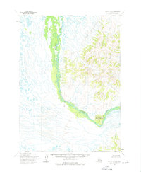
1954 Map of Bethel B-6
USGS Topo · Published 1976About this map
Kwethluk River winds through this subarctic terrain, defining the transition from the low-lying western wetlands to the dramatic elevation of the eastern highlands. Mapped from aerial photography taken in the mid-1950s, the sheet illustrates a complex drainage network where countless small tributaries and unnamed ponds feed into the primary river channel. The most prominent topographic landmark is Elbow Mountain, which rises sharply from the river bend to anchor the southeastern portion of the quadrangle. North of this peak, Coral Creek carves a narrow valley through the upland ridges, contributing to the rugged character of the Kuskokwim Mountains foothills. This survey records a wilderness landscape devoid of established roads or permanent settlements at the time of annotation, highlighting the natural geography before later development in the region.
Find a feature on this map
3 named features on this map. Tap any name to fly to it.
Don’t see what you’re looking for? This feature index may not catch every label — zoom into the map to look around manually.
Map Details
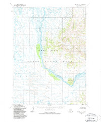
Editions of this 1954 Bethel B-6 Map
3 editions found
Other maps of this area

1950 · Bethel
USGS Topo · 1:250,000

1954 · Bethel B-6
USGS Topo · 1:63,360

1954 · Bethel C-6
USGS Topo · 1:63,360

1954 · Bethel C-5
USGS Topo · 1:63,360

1954 · Bethel B-7
USGS Topo · 1:63,360

1954 · Bethel A-5
USGS Topo · 1:63,360
1954 · Bethel C-7
USGS Topo · 1:63,360

1954 · Bethel B-5
USGS Topo · 1:63,360

1954 · Bethel A-7
USGS Topo · 1:63,360

1954 · Bethel A-6
USGS Topo · 1:63,360