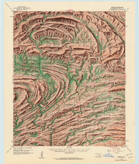
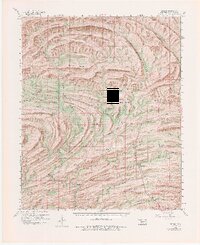
1960 Map of Bethel
USGS Topo · Published 1963About this map
Dramatic ridge-and-valley topography characterizes this 1960s study of McCurtain County, where the Boktukola Mountains and Sulphur Mountain create a complex landscape of parallel ranges and deep drainage basins. The Industrial Railroad cuts a winding path through the southern half of the quadrangle, serving the timber and resource interests of the era alongside the Glover River and Little River.
Find a feature on this map
52 named features on this map. Tap any name to fly to it.
Don’t see what you’re looking for? This feature index may not catch every label — zoom into the map to look around manually.
Map Details
Editions of this 1960 Bethel Map
6 editions found

Other maps of this area

1900 · Winding Stair
USGS Topo · 1:125,000

1901 · Tuskahoma
USGS Topo · 1:125,000

1901 · Alikchi
USGS Topo · 1:125,000

1902 · Lukfata
USGS Topo · 1:125,000

1908 · Tuskahoma
USGS Topo · 1:125,000

1909 · Tuskahoma
USGS Topo · 1:125,000

1909 · Winding Stair
USGS Topo · 1:125,000

1950 · Mcalester
USGS Topo · 1:250,000

1959 · Page
USGS Topo · 1:62,500

1959 · Golden
USGS Topo · 1:62,500