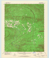
1960 Map of Bethel
USGS Topo · Published 1967About this map
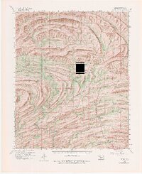
Boktuklo Mountains and the dense ridgelines of the Ouachita National Forest dominate this 1960s perspective of McCurtain County. The map details a landscape defined by industrial timber harvesting and isolated mountain communities, where the Industrial Railroad snakes through the valley of Clover Creek and Big Horseshoe Mountain. Small settlements like Battiest and Bethel serve as the primary hubs, each anchored by local landmarks such as Mt Zion Ch, Silver Creek Ch, and North Bethel Sch.
Find a feature on this map
49 named features on this map. Tap any name to fly to it.
Don’t see what you’re looking for? This feature index may not catch every label — zoom into the map to look around manually.
Map Details
Editions of this 1960 Bethel Map
6 editions found

Other maps of this area

1900 · Winding Stair
USGS Topo · 1:125,000

1901 · Tuskahoma
USGS Topo · 1:125,000

1901 · Alikchi
USGS Topo · 1:125,000

1902 · Lukfata
USGS Topo · 1:125,000

1908 · Tuskahoma
USGS Topo · 1:125,000

1909 · Tuskahoma
USGS Topo · 1:125,000

1909 · Winding Stair
USGS Topo · 1:125,000

1950 · Mcalester
USGS Topo · 1:250,000

1959 · Page
USGS Topo · 1:62,500

1959 · Golden
USGS Topo · 1:62,500