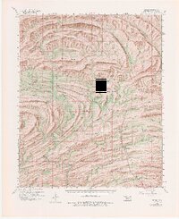
1960 Map of Bethel
USGS Topo · Published 1980About this map
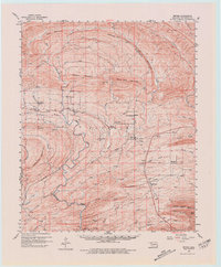
Sulphur Mountain and the surrounding ridges of McCurtain County dominate this 1960s landscape, where the Industrial Railroad cuts through the timbered terrain of the Ouachita foothills. The settlement of Battiest and the nearby community of Bethel serve as local hubs, connected by a network of creeks like Coon Creek and Winship Branch. Local life centers around several rural institutions, including the North Bethel School and Bethel Hill Church, which stands near the Bethel Hill Cemetery. The mapping reveals a distinct pattern of valley floor habitation along the Glover River and Little Pine Creek, while higher elevations like High Peak and White Rock Mountain remain primarily managed for forestry and fire observation, indicated by the Lookout Tower on the eastern ridges. This era captures the region's transition into a more integrated forest-industry economy, anchored by the railway and small mountain hamlets like Sherwood and Mt Herman.
Find a feature on this map
53 named features on this map. Tap any name to fly to it.
Don’t see what you’re looking for? This feature index may not catch every label — zoom into the map to look around manually.
Map Details
Editions of this 1960 Bethel Map
6 editions found

Other maps of this area

1900 · Winding Stair
USGS Topo · 1:125,000

1901 · Tuskahoma
USGS Topo · 1:125,000

1901 · Alikchi
USGS Topo · 1:125,000

1902 · Lukfata
USGS Topo · 1:125,000

1908 · Tuskahoma
USGS Topo · 1:125,000

1909 · Tuskahoma
USGS Topo · 1:125,000

1909 · Winding Stair
USGS Topo · 1:125,000

1950 · Mcalester
USGS Topo · 1:250,000

1959 · Page
USGS Topo · 1:62,500

1959 · Golden
USGS Topo · 1:62,500