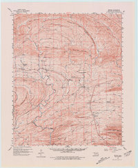
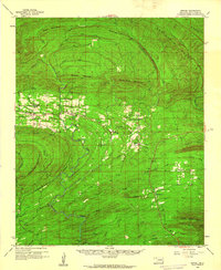
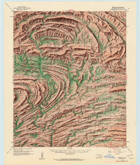
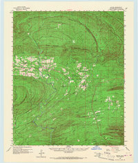
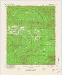
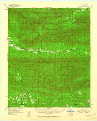
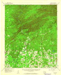
1960 Map of Bethel
USGS Topo · Published 1980About this map
The Glover River meanders through the heart of the McCurtain County highlands, carving a path between Big Horseshoe Mountain and the expansive ridge lines of Short Mountain and White Rock Mountain. This 1960 field-checked survey reveals an era of active timber or resource extraction, prominently featuring the Industrial Railroad following the river valley through the southern half of the quadrangle. Small rural settlements like Battiest and Bethel serve as the primary hubs for this mountain community, each supported by local institutions such as Mt Zion Ch and North Bethel Sch. The map provides excellent detail for genealogists, marking family-connected sites including the Battiest Cem and Bethel Hill Cem. High elevations are anchored by landmarks like the Mtn Lookout Tower atop a peak overlooking the numerous tributaries of Boktuklo Creek.
Find a feature on this map
49 named features on this map. Tap any name to fly to it.
Don’t see what you’re looking for? This feature index may not catch every label — zoom into the map to look around manually.
Map Details
Editions of this 1960 Bethel Map
6 editions found
Other maps of this area

1900 · Winding Stair
USGS Topo · 1:125,000

1901 · Tuskahoma
USGS Topo · 1:125,000

1901 · Alikchi
USGS Topo · 1:125,000
1902 · Lukfata
USGS Topo · 1:125,000

1908 · Tuskahoma
USGS Topo · 1:125,000

1909 · Tuskahoma
USGS Topo · 1:125,000
1909 · Winding Stair
USGS Topo · 1:125,000

1950 · Mcalester
USGS Topo · 1:250,000
1959 · Page
USGS Topo · 1:62,500
1959 · Golden
USGS Topo · 1:62,500