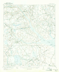
1921 Map of Bowman
USGS Topo · Published 1921About this map
Four Hole Swamp and its many tributaries, including Goodbys Swamp and Bull Swamp, dominate this Lowcountry landscape during the early 1920s. This survey reveals a dense network of rural community hubs, represented by dozens of neighborhood schools such as Livingston Mill School and Indian Camp School. The settlement of Bowman serves as a central point for local travel, connected by the Branchville and Bowman Road.
Find a feature on this map
78 named features on this map. Tap any name to fly to it.
Don’t see what you’re looking for? This feature index may not catch every label — zoom into the map to look around manually.
Map Details
Editions of this 1921 Bowman Map
4 editions found

Other maps of this area

1919 · Ridgeville
USGS Topo · 1:48,000

1919 · Lodge
USGS Topo · 1:62,500

1920 · Eutawville
USGS Topo · 1:48,000

1920 · Bowman
USGS Topo · 1:48,000

1920 · Lodge
USGS Topo · 1:48,000

1920 · Ridgeville
USGS Topo · 1:62,500

1920 · Orangeburg
USGS Topo · 1:48,000

1920 · St. George
USGS Topo · 1:48,000

1921 · Orangeburg
USGS Topo · 1:62,500

1921 · Lodge
USGS Topo · 1:62,500