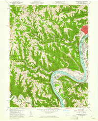
1960 Map of Businessburg
USGS Topo · Published 1961About this map
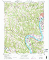
The Ohio River flows through a landscape defined by industrial development and traditional river valley settlements during the early 1960s. Along the eastern bank, Moundsville and McKeefrey stand as primary hubs of activity, connected by the Baltimore and Ohio railroad. On the Ohio side, the topography rises sharply from the riverbanks at Dilles Bottom into the ridge-and-hollow terrain of Richland Ridge and Ash Ridge. This area shows a complex mix of land use, from the Moundsville Golf Course and Washington Lands Sch to the industrial presence of Strip Mines and a Gravel Pit. Local life is anchored by dispersed institutions like Belmont United Ch and the Mead Local Sch, while family history is etched into the land at Riverview Cemetery and Mt Zion Cem.
Find a feature on this map
63 named features on this map. Tap any name to fly to it.
Don’t see what you’re looking for? This feature index may not catch every label — zoom into the map to look around manually.
Map Details
Editions of this 1960 Businessburg Map
5 editions found
Other maps of this area

1902 · Wheeling
USGS Topo · 1:62,500

1904 · Cameron
USGS Topo · 1:62,500

1905 · Clarington
USGS Topo · 1:62,500

1905 · St. Clairsville
USGS Topo · 1:62,500

1935 · Cameron
USGS Topo · 1:62,500

1935 · Clarington
USGS Topo · 1:62,500

1935 · Wheeling
USGS Topo · 1:62,500

1940 · Clarington
USGS Topo · 1:62,500

1942 · Cameron
USGS Topo · 1:62,500

1942 · Wheeling
USGS Topo · 1:62,500