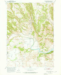
1950 Map of Cascade Springs
USGS Topo · Published 1976About this map
Brainerd Indian Training School and several rural schoolhouses highlight the mid-century social landscape of this Fall River County region. Situated within the Harney National Forest, the terrain is defined by a dense network of canyons, including Alabaugh Canyon and Payne Canyon, which drain toward the Cheyenne River. The 1950 field check captures the area during the development of the Missouri River Basin, showing the Angostura Reservoir and an extensive Irrigation Ditch system essential for local agriculture.
Find a feature on this map
42 named features on this map. Tap any name to fly to it.
Don’t see what you’re looking for? This feature index may not catch every label — zoom into the map to look around manually.
Map Details
Editions of this 1950 Cascade Springs Map
Other maps of this area

1896 · Oelrichs
USGS Topo · 1:125,000

1900 · Oelrichs
USGS Topo · 1:125,000

1902 · Edgemont
USGS Topo · 1:125,000

1950 · Hot Springs
USGS Topo · 1:24,000

1950 · Heppner
USGS Topo · 1:24,000

1950 · Cascade Springs
USGS Topo · 1:24,000

1950 · Angostura Reservoir
USGS Topo · 1:24,000

1950 · Rumford
USGS Topo · 1:24,000

1950 · Minnekahta
USGS Topo · 1:24,000

1950 · Flint Hill
USGS Topo · 1:24,000