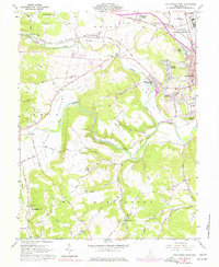
1961 Map of Chillicothe West
USGS Topo · Published 1977About this map
The North Fork Paint Creek and Paint Creek define the landscape of Ross County, where the industrial and institutional expansion of Chillicothe meets the rural ridges of southern Ohio. This mid-century survey documents a dense concentration of civic landmarks, including the V A Hospital, the Chillicothe Federal Reformatory, and the Mound City Group Nat Mon. The infrastructure of the Baltimore and Ohio Railroad anchors the northern corridor, connecting settlements like Slate Mills and Anderson to the regional hub.
Find a feature on this map
70 named features on this map. Tap any name to fly to it.
Don’t see what you’re looking for? This feature index may not catch every label — zoom into the map to look around manually.
Map Details
Editions of this 1961 Chillicothe West Map
4 editions found
Other maps of this area

1906 · Waverly
USGS Topo · 1:62,500

1906 · Chillicothe
USGS Topo · 1:62,500

1908 · Chillicothe
USGS Topo · 1:62,500

1908 · Waverly
USGS Topo · 1:62,500

1912 · Roxabell
USGS Topo · 1:62,500

1914 · Roxabell
USGS Topo · 1:62,500

1915 · Piketon
USGS Topo · 1:62,500

1917 · Piketon
USGS Topo · 1:62,500

1944 · Piketon
USGS Topo · 1:62,500

1944 · Roxabell
USGS Topo · 1:62,500