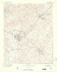
1951 Map of Clemson
USGS Topo · Published 1952About this map
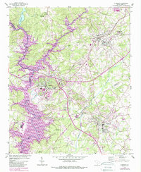
Clemson Agricultural College serves as a central landmark in this 1951 study, showing the campus before the creation of major reservoirs fundamentally altered the surrounding river valleys. The landscape is defined by the winding course of the Seneca River and its confluence with Twelvemile Creek and Eighteenmile Creek. These waterways, along with the Southern railroad line, historically dictated the placement of settlements like Central, Calhoun, and Pendleton.
Find a feature on this map
44 named features on this map. Tap any name to fly to it.
Don’t see what you’re looking for? This feature index may not catch every label — zoom into the map to look around manually.
Map Details
Editions of this 1951 Clemson Map
6 editions found
Other maps of this area

1888 · Pickens
USGS Topo · 1:125,000

1894 · Pickens
USGS Topo · 1:125,000

1950 · La France
USGS Topo · 1:24,000

1951 · La France
USGS Topo · 1:24,000

1951 · Clemson
USGS Topo · 1:24,000

1954 · Greenville
USGS Topo · 1:250,000

1957 · Anderson
USGS Topo · 1:62,500

1957 · Easley
USGS Topo · 1:62,500

1958 · Greenville
USGS Topo · 1:250,000

1958 · Seneca
USGS Topo · 1:24,000