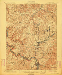
1902 Map of Connellsville
USGS Topo · Published 1911About this map
Industrial and agrarian life in Westmoreland and Fayette Counties centers on the winding Youghiogheny River and a dense network of early 20th-century railroads. The B.& O. R.R. and Pennsylvania R.R. lines trace the riverbanks and mountain gaps, serving a region defined by its natural resources and early manufacturing. Notable nodes like Connellsville and Perryopolis anchor the landscape, while smaller hamlets such as Bells Mills and Mill Grove appear alongside specialized industrial sites like Summit Mines and Star Mines.
Find a feature on this map
140 named features on this map. Tap any name to fly to it.
Don’t see what you’re looking for? This feature index may not catch every label — zoom into the map to look around manually.
Map Details
Editions of this 1902 Connellsville Map
5 editions found
Other maps of this area

1900 · Uniontown
USGS Topo · 1:62,500

1900 · Masontown
USGS Topo · 1:62,500

1900 · Latrobe
USGS Topo · 1:62,500

1902 · Latrobe
USGS Topo · 1:62,500

1902 · Brownsville
USGS Topo · 1:62,500

1902 · Connellsville
USGS Topo · 1:62,500

1903 · Masontown
USGS Topo · 1:62,500

1903 · Latrobe
USGS Topo · 1:62,500

1904 · Mc Keesport
USGS Topo · 1:62,500

1904 · Greensburg
USGS Topo · 1:62,500