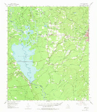
1955 Map of Curtis
USGS Topo · Published 1975About this map
The confluence of the Neches River and Angelina River defines the landscape of this 1950s survey, dominated by the newly formed waters of B.A. Steinhagen Lake. The construction of the Town Bluff Dam significantly altered the regional geography, inundating many of the intricate bottomland features such as Bee Tree Slough and Big Pine Island. Along the eastern shores and upland ridges, a network of rural communities like Nedville and Beech Grove persists, characterized by family-named landmarks and local institutions like Graham Sch and Graham Ch.
Find a feature on this map
132 named features on this map. Tap any name to fly to it.
Don’t see what you’re looking for? This feature index may not catch every label — zoom into the map to look around manually.
Map Details
Editions of this 1955 Curtis Map
3 editions found
Other maps of this area

1931 · Zavalla
USGS Topo · 1:62,500

1952 · Lake Charles
USGS Topo · 1:250,000

1953 · Alexandria
USGS Topo · 1:250,000

1953 · Palestine
USGS Topo · 1:250,000

1954 · Lake Charles
USGS Topo · 1:250,000

1954 · Beaumont
USGS Topo · 1:250,000

1955 · Alexandria
USGS Topo · 1:250,000

1955 · Roganville
USGS Topo · 1:62,500

1955 · Woodville
USGS Topo · 1:62,500

1955 · Curtis
USGS Topo · 1:62,500