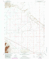
1954 Map of Dugway Proving Ground NW
USGS Topo · Published 1984About this map
Dugway Proving Ground dominates this 1954 topographic survey, illustrating a vast military landscape in Tooele County. The map details a transition from the mid-century period of planetable surveying to the early 1980s when revisions were added via aerial photography. The terrain is characterized by expansive, level basins punctuated by isolated landforms, most notably the seasonal catchment of Dry Lake in the southern portion of the sheet. Transportation is defined by long, straight desert tracks including Goodyear Road, Stark Road, and Falconer Road, which cut through the open desert floor to connect remote military installations and observation points. The lack of permanent settlements emphasizes the restricted nature of this high-desert testing range during the Cold War era.
Find a feature on this map
6 named features on this map. Tap any name to fly to it.
Don’t see what you’re looking for? This feature index may not catch every label — zoom into the map to look around manually.
Map Details
Editions of this 1954 Dugway Proving Ground NW Map
4 editions found
Other maps of this area

1953 · Tooele
USGS Topo · 1:250,000

1954 · Wig Mtn SW
USGS Topo · 1:24,000

1954 · Dugway Proving Ground SE
USGS Topo · 1:24,000

1954 · Dugway Proving Ground NE
USGS Topo · 1:24,000

1954 · Granite Peak
USGS Topo · 1:24,000

1954 · Dugway Proving Ground SW
USGS Topo · 1:24,000

1954 · Wildcat Mtn SE
USGS Topo · 1:24,000

1954 · Dugway Proving Ground NW
USGS Topo · 1:24,000

1954 · Granite Peak SE
USGS Topo · 1:24,000

1955 · Wig Mtn
USGS Topo · 1:24,000