
1956 Map of Dyersburg
USGS Topo · Published 1960About this map
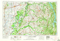
Mississippi River and Ohio River confluence dominates this mid-century portrait of the Four Rivers region, where Tennessee, Kentucky, Missouri, and Illinois meet. The landscape is defined by its complex hydrologic network, featuring the sprawling Reelfoot Lake and the massive impoundment of Kentucky Lake to the east. Extensive drainage and flood control measures are visible across the Missouri Bootheel, including the prominent New Madrid Floodway and a dense grid of unnamed ditches near Portageville and Gideon.
Find a feature on this map
99 named features on this map. Tap any name to fly to it.
Don’t see what you’re looking for? This feature index may not catch every label — zoom into the map to look around manually.
Map Details
Editions of this 1956 Dyersburg Map
4 editions found
Other maps of this area

1908 · Princeton
USGS Topo · 1:62,500

1910 · Princeton
USGS Topo · 1:62,500

1925 · Reelfoot Lake
USGS Topo · 1:62,500

1926 · Paducah
USGS Topo · 1:62,500

1928 · Eddyville
USGS Topo · 1:48,000

1928 · La Center
USGS Topo · 1:62,500

1929 · Smithland
USGS Topo · 1:62,500

1929 · Paducah
USGS Topo · 1:62,500

1931 · Sikeston
USGS Topo · 1:62,500

1931 · Eddyville
USGS Topo · 1:62,500