
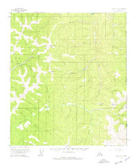
1956 Map of Eagle A-1
USGS Topo · Published 1963About this map
The Taylor Highway and several Tractor Trails snake through the gold-bearing drainages of the Fortymile District along the international border with Canada. Evidence of industrial-scale gold recovery is prominent, with extensive Dredge Tailings and a Placer Mine marking the creeks where miners once sought their fortunes. The settlement of Jack Wade serves as a focal point for the region's mid-century activity, supported by both the Jack Wade Landing Strip and the Boundary Landing Strip further east. The landscape is defined by high peaks like Steele Creek Dome and Davis Dome, which overlook a complex network of waterways including the Walker Fork and South Fork. This survey documents a working wilderness where the infrastructure of aviation and resource extraction met the rigid line of the Alaska Yukon boundary.
Find a feature on this map
54 named features on this map. Tap any name to fly to it.
Don’t see what you’re looking for? This feature index may not catch every label — zoom into the map to look around manually.
Map Details
Editions of this 1956 Eagle A-1 Map
4 editions found
Other maps of this area

1899 · Fortymile
USGS Topo · 1:250,000

1949 · Tanacross
USGS Topo · 1:250,000

1950 · Tanacross
USGS Topo · 1:250,000

1951 · Eagle
USGS Topo · 1:250,000

1956 · Tanacross D-2
USGS Topo · 1:63,360

1956 · Tanacross D-1
USGS Topo · 1:63,360

1956 · Eagle B-2
USGS Topo · 1:63,360

1956 · Eagle A-2
USGS Topo · 1:63,360

1956 · Eagle B-1
USGS Topo · 1:63,360

1956 · Tanacross
USGS Topo · 1:250,000