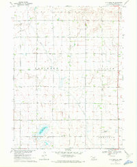
1970 Map of Elm Creek SW
USGS Topo · Published 1972About this map
Phelps County Canal cuts diagonally across this central Nebraska landscape, a testament to the intricate water management required for agriculture in the region. The map captures the organized township structures of Williamsburg, Westmark, Center, Laird, and Sheridan, revealing a rural fabric defined by section lines and isolated landmarks. Cultural hubs for the 1970s community are preserved here, including the Holcomb Ch and School No 4, reflecting the importance of local institutions in the Phelps County plains. Notable geographic features such as Moses Hill and the nearby Moses Hill Lagoon provide localized relief in an otherwise strictly surveyed grid. The presence of the Radio Towers (KRVN) and a specific Flume along the canal route highlights the era's communication and irrigation infrastructure during the Missouri River Basin development program.
Find a feature on this map
21 named features on this map. Tap any name to fly to it.
Don’t see what you’re looking for? This feature index may not catch every label — zoom into the map to look around manually.
Map Details
Editions of this 1970 Elm Creek SW Map
This is the sole edition of this map. No revisions or reprints were ever made.
Other maps of this area

1896 · Lexington
USGS Topo · 1:125,000

1896 · Holdrege
USGS Topo · 1:125,000

1896 · Kearney
USGS Topo · 1:125,000

1896 · Arapahoe
USGS Topo · 1:125,000

1898 · Arapahoe
USGS Topo · 1:125,000

1899 · Lexington
USGS Topo · 1:125,000

1955 · Grand Island
USGS Topo · 1:250,000

1957 · Grand Island
USGS Topo · 1:250,000

1958 · Grand Island
USGS Topo · 1:250,000

1961 · Elm Creek West
USGS Topo · 1:24,000