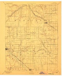
1894 Map of Eskridge
USGS Topo · Published 1906About this map
Council Grove and the surrounding Flint Hills landscape are captured in this late 19th-century reconnaissance, conducted under J.W. Powell. The map reveals a complex network of early railroads that shaped the region's development, including the Chicago Rock Island and Pacific RR and the Atchison Topeka and Santa Fe Railroad. These rail lines connected established hubs like Eskridge and Americus while supporting smaller trackside points such as Volland and Halifax.
Find a feature on this map
84 named features on this map. Tap any name to fly to it.
Don’t see what you’re looking for? This feature index may not catch every label — zoom into the map to look around manually.
Map Details
Editions of this 1894 Eskridge Map
5 editions found

Other maps of this area

1885 · Eskridge
USGS Topo · 1:125,000

1885 · Burlington
USGS Topo · 1:125,000

1886 · Junction City
USGS Topo · 1:125,000

1888 · Emporia
USGS Topo · 1:125,000

1889 · Burlingame
USGS Topo · 1:125,000

1889 · Wamego
USGS Topo · 1:125,000

1889 · Junction City
USGS Topo · 1:125,000

1889 · Parkerville
USGS Topo · 1:125,000

1889 · Eskridge
USGS Topo · 1:125,000

1889 · Topeka
USGS Topo · 1:125,000