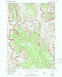
1956 Map of Five Pockets
USGS Topo · Published 1987About this map
Shoshone National Forest encompasses this high-altitude landscape along the border of Park and Fremont counties, as surveyed in the mid-1950s. The terrain is defined by dramatic geological formations, from the broad Shoshone Plateau in the north to the sharp ascent of The Ramshorn in the south. The area’s hydrological system is particularly intricate, featuring the descent of Twilight Falls and a series of alpine water bodies including Hidden Lake, Eloise Lake, and Deacon Lake.
Find a feature on this map
33 named features on this map. Tap any name to fly to it.
Don’t see what you’re looking for? This feature index may not catch every label — zoom into the map to look around manually.
Map Details
Editions of this 1956 Five Pockets Map
3 editions found
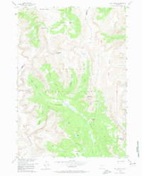
Other maps of this area

1905 · Younts Peak
USGS Topo · 1:125,000

1907 · Younts Peak
USGS Topo · 1:125,000

1955 · Thermopolis
USGS Topo · 1:250,000

1956 · Indian Point
USGS Topo · 1:24,000

1956 · Esmond Park
USGS Topo · 1:24,000

1956 · Shoshone Pass
USGS Topo · 1:24,000

1956 · Ramshorn Peak
USGS Topo · 1:24,000

1956 · Snow Lake
USGS Topo · 1:24,000

1956 · Five Pockets
USGS Topo · 1:24,000

1956 · Emerald Lake
USGS Topo · 1:24,000