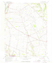
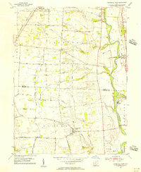
1958 Map of Five Points
USGS Topo · Published 1975About this map
Agricultural life in Pickaway County is centered on the junction of Five Points and the small settlement of Era to the northwest. The landscape is defined by the winding course of Deer Creek and Buskirk Creek, which feed into the southwestern corner at Deer Creek Lake. This 1958 survey, updated with aerial data through 1974, captures the rural road network including the Palestine-Williamsport Road and Darbyville-Palestine Road, which connect isolated farmsteads and historic family-named landmarks.
Find a feature on this map
39 named features on this map. Tap any name to fly to it.
Don’t see what you’re looking for? This feature index may not catch every label — zoom into the map to look around manually.
Map Details
Editions of this 1958 Five Points Map
4 editions found
Other maps of this area

1906 · Mt Sterling
USGS Topo · 1:62,500

1907 · London
USGS Topo · 1:62,500

1911 · Era
USGS Topo · 1:62,500

1913 · Era
USGS Topo · 1:62,500

1923 · West Columbus
USGS Topo · 1:62,500

1925 · West Columbus
USGS Topo · 1:62,500

1943 · Era
USGS Topo · 1:62,500

1947 · Columbus
USGS Topo · 1:250,000

1955 · Harrisburg
USGS Topo · 1:24,000
1955 · Commercial Point
USGS Topo · 1:24,000