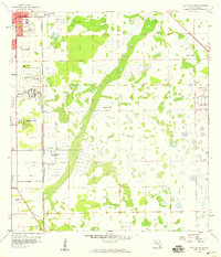
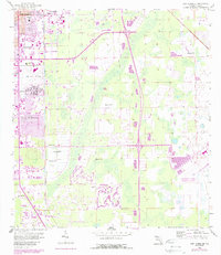
1958 Map of Fort Myers SE
USGS Topo · Published 1959About this map
The growing outskirts of Fort Myers are captured in this late 1950s survey, showing the northward expansion of residential tracts like Fort Myers Villas and Page Park. Transportation and infrastructure are central to the landscape, dominated by the Page Airport and the Atlantic Coast Line railroad running parallel to the Tenmile drainage. The map provides a look at mid-century community life through labels for the Jr High Sch, a Drive-in Theater, and the Radio Towers (WMYR). Beyond the settled areas, the terrain is defined by a series of Flowing Wells and a straight Canal system, reflecting the ongoing efforts to manage the Florida wetlands for development and agriculture. Local landmarks like the County Home offer specific points of interest for genealogists researching the institutional history of Lee County.
Find a feature on this map
16 named features on this map. Tap any name to fly to it.
Don’t see what you’re looking for? This feature index may not catch every label — zoom into the map to look around manually.
Map Details
Editions of this 1958 Fort Myers SE Map
5 editions found
Other maps of this area

1956 · West Palm Beach
USGS Topo · 1:250,000

1957 · West Palm Beach
USGS Topo · 1:250,000

1958 · West Palm Beach
USGS Topo · 1:250,000

1958 · Corkscrew NW
USGS Topo · 1:24,000

1958 · Fort Myers NW
USGS Topo · 1:24,000

1958 · Estero
USGS Topo · 1:24,000

1958 · Fort Myers SW
USGS Topo · 1:24,000

1958 · Olga
USGS Topo · 1:24,000

1958 · Alva SW
USGS Topo · 1:24,000

1958 · Fort Myers
USGS Topo · 1:24,000