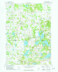
1973 Map of Gregory
USGS Topo · Published 1977About this map
Portage Creek and Livermore Creek wind through this Livingston County landscape, connecting a dense network of glacial lakes and wetlands. The settlement of Gregory sits at a crossroads in the north, while Unadilla and Williamsville anchor the central portion of the quadrangle. The map captures a transition in land use, where traditional agriculture, evidenced by the Collins Plains Cem and Smith Farm Landing Field, meets growing recreational demands within the Pinckney State Recreation Area and Unadilla State Wildlife Area.
Find a feature on this map
83 named features on this map. Tap any name to fly to it.
Don’t see what you’re looking for? This feature index may not catch every label — zoom into the map to look around manually.
Map Details
Editions of this 1973 Gregory Map
3 editions found
Other maps of this area

1902 · Dexter
USGS Topo · 1:62,500

1904 · Ann Arbor
USGS Topo · 1:125,000

1906 · Dexter
USGS Topo · 1:62,500

1907 · Howell
USGS Topo · 1:62,500

1908 · Ann Arbor
USGS Topo · 1:125,000

1908 · Fowlerville
USGS Topo · 1:62,500

1909 · Howell
USGS Topo · 1:62,500

1910 · Fowlerville
USGS Topo · 1:62,500

1919 · Stockbridge
USGS Topo · 1:62,500

1922 · Stockbridge
USGS Topo · 1:62,500
Featured Places
- Putnam Township, MI
- Dexter Township, MI
- Unadilla, Unadilla Township
- Unadilla Township, MI
- Lyndon Township, MI