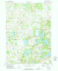
1973 Map of Gregory
USGS Topo · Published 1989About this map
Glacial lake clusters and marshy lowlands dominate the boundary between Livingston and Washtenaw counties in the early 1970s. The village of Gregory serves as a central hub, situated near the intersection of the Railroad Grade and Dexter Trail. To the south, the Pinckney State Recreation Area encompasses a dense network of water bodies including Bruin Lake, Patterson Lake, and Halfmoon Lake. These areas reflect a landscape transitioning from agriculture to seasonal recreation, evidenced by numerous campgrounds like Camp Grindley and the Fresh Air Camp.
Find a feature on this map
84 named features on this map. Tap any name to fly to it.
Don’t see what you’re looking for? This feature index may not catch every label — zoom into the map to look around manually.
Map Details
Editions of this 1973 Gregory Map
3 editions found
Other maps of this area

1902 · Dexter
USGS Topo · 1:62,500

1904 · Ann Arbor
USGS Topo · 1:125,000

1906 · Dexter
USGS Topo · 1:62,500

1907 · Howell
USGS Topo · 1:62,500

1908 · Ann Arbor
USGS Topo · 1:125,000

1908 · Fowlerville
USGS Topo · 1:62,500

1909 · Howell
USGS Topo · 1:62,500

1910 · Fowlerville
USGS Topo · 1:62,500

1919 · Stockbridge
USGS Topo · 1:62,500

1922 · Stockbridge
USGS Topo · 1:62,500
Featured Places
- Putnam Township, MI
- Dexter Township, MI
- Unadilla, Unadilla Township
- Unadilla Township, MI
- Lyndon Township, MI