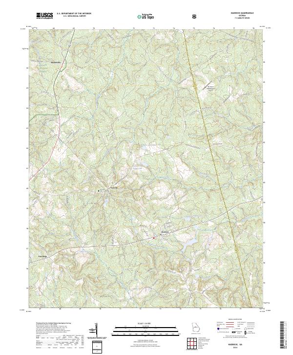
2024 Map of Haddock
USGS Topo · Published 2024About this map
The town of Haddock serves as a central hub in this landscape along the border of Jones and Baldwin Counties. The area is characterized by a network of creeks and drainage basins, including Commissioner Creek and Potato Creek, which feed into several private impoundments such as Williams Lake Number One and Williams Lake Number Two. To the northwest, the Oconee National Forest provides a protected wooded backdrop to the small community of Blountsville. Local history and genealogy interest is concentrated around the settlement of Fortville, where the Fortville Cem remains a primary landmark. The road network, including Fortville Milledgeville Rd and Old Monticello Rd NW, reflects the long-standing transit corridors between Middle Georgia's early agricultural and governmental centers. The presence of the Brookline-Meadowmere Airport indicates the modern evolution of land use in this traditionally rural and forested terrain.
Find a feature on this map
76 named features on this map. Tap any name to fly to it.
Don’t see what you’re looking for? This feature index may not catch every label — zoom into the map to look around manually.
Map Details
Editions of this 2024 Haddock Map
This is the sole edition of this map. No revisions or reprints were ever made.
Other maps of this area

1953 · Athens
USGS Topo · 1:250,000

1956 · Gordon
USGS Topo · 1:62,500

1956 · Macon
USGS Topo · 1:62,500

1957 · Macon
USGS Topo · 1:250,000

1958 · Macon
USGS Topo · 1:250,000

1958 · Athens
USGS Topo · 1:250,000

1959 · Athens
USGS Topo · 1:250,000

1963 · Athens
USGS Topo · 1:250,000

1964 · Macon
USGS Topo · 1:250,000

1964 · Gray
USGS Topo · 1:24,000