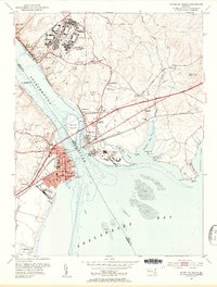
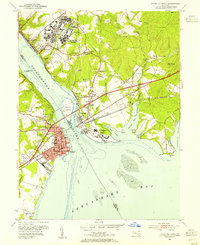
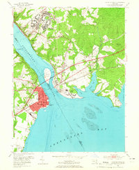
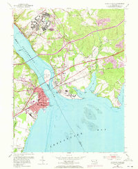
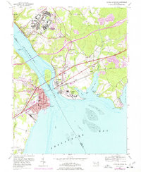
1953 Map of Havre De Grace
USGS Topo · Published 1955About this map
Havre De Grace and Perryville face each other across the mouth of the Susquehanna River in this 1953 revision. The landscape is defined by the massive footprint of the Bainbridge Naval Training Center on the heights above Port Deposit, featuring an Amphitheater and Golf Course. To the south, Perry Point is dominated by the U S Veterans Hospital complex.
Find a feature on this map
57 named features on this map. Tap any name to fly to it.
Don’t see what you’re looking for? This feature index may not catch every label — zoom into the map to look around manually.
Map Details
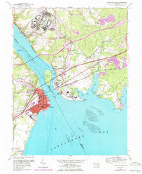
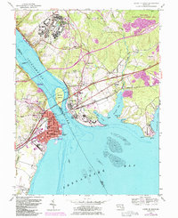
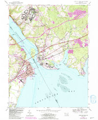
Editions of this 1953 Havre De Grace Map
8 editions found
Other maps of this area

1898 · Elkton
USGS Topo · 1:62,500

1898 · Tolchester
USGS Topo · 1:125,000

1899 · Dover
USGS Topo · 1:125,000

1900 · Elkton
USGS Topo · 1:62,500

1900 · Cecilton
USGS Topo · 1:62,500

1900 · Havre De Grace
USGS Topo · 1:62,500

1900 · Betterton
USGS Topo · 1:62,500

1903 · Tolchester
USGS Topo · 1:125,000

1906 · Dover
USGS Topo · 1:125,000

1908 · Tolchester
USGS Topo · 1:125,000