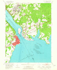
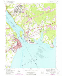
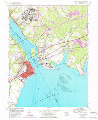
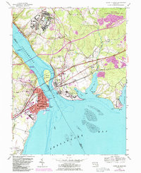
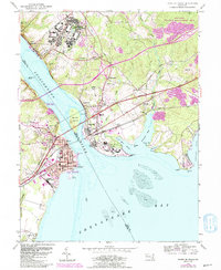
1953 Map of Havre De Grace
USGS Topo · Published 1965About this map
Havre De Grace anchors the western bank of the Susquehanna River in this mid-century survey, showing the city's dense grid of streets like Revolution St and Market St meeting the waterfront at Concord Pt. Across the water, the expansive Bainbridge Naval Training Center dominates the hills above Port Deposit, featuring an Amphitheater and numerous military structures. The landscape is defined by the intersection of major transportation and institutional hubs, including the Pennsylvania railroad lines and the sprawling grounds of the U S Veterans Hospital at Perry Point. Local history and genealogy are well-represented by rural landmarks such as Cokesbury Ch, Principio Furnace, and family burial sites like Patterson Cem. The map captures a moment when industrial sites like the Quarry near Blythedale operated alongside significant federal and military installations at the head of the Chesapeake Bay.
Find a feature on this map
65 named features on this map. Tap any name to fly to it.
Don’t see what you’re looking for? This feature index may not catch every label — zoom into the map to look around manually.
Map Details
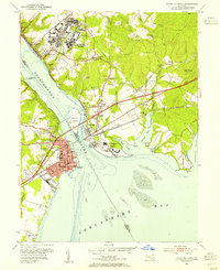
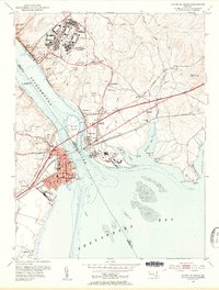
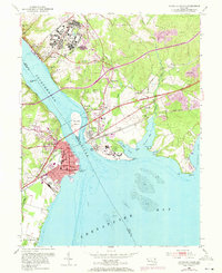
Editions of this 1953 Havre De Grace Map
8 editions found
Other maps of this area

1898 · Elkton
USGS Topo · 1:62,500

1898 · Tolchester
USGS Topo · 1:125,000

1899 · Dover
USGS Topo · 1:125,000

1900 · Elkton
USGS Topo · 1:62,500

1900 · Cecilton
USGS Topo · 1:62,500

1900 · Havre De Grace
USGS Topo · 1:62,500

1900 · Betterton
USGS Topo · 1:62,500

1903 · Tolchester
USGS Topo · 1:125,000

1906 · Dover
USGS Topo · 1:125,000

1908 · Tolchester
USGS Topo · 1:125,000