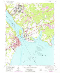
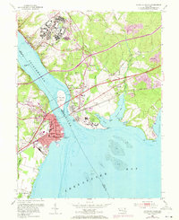
1953 Map of Havre De Grace
USGS Topo · Published 1977About this map
Havre De Grace and Perryville face one another across the mouth of the Susquehanna River, connected by road and rail bridges that define this critical corridor of the Chesapeake region. The landscape reflects a mix of deep-rooted industry and large-scale military and medical institutions established by the mid-20th century. Notable among these is the Bainbridge Naval Training Center on the heights above Port Deposit, while the U S Veterans Hospital occupies the prominent Perry Point. Trace the legacy of early ironwork at Principio Furnace near Principio Creek, or locate local landmarks like the Concord Pt Lighthouse and various family-named sites such as Patterson Cem and Foys Hill. The map meticulously details the transit networks of the Penn Central and Baltimore and Ohio railroads, which share the coastline with the General Pulaski Highway.
Find a feature on this map
62 named features on this map. Tap any name to fly to it.
Don’t see what you’re looking for? This feature index may not catch every label — zoom into the map to look around manually.
Map Details
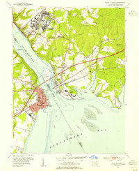
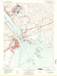
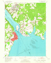
Editions of this 1953 Havre De Grace Map
8 editions found
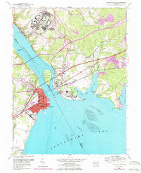
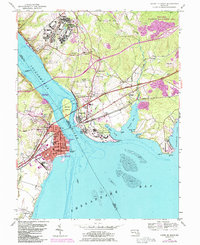
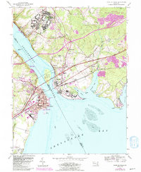
Other maps of this area

1898 · Elkton
USGS Topo · 1:62,500

1898 · Tolchester
USGS Topo · 1:125,000

1899 · Dover
USGS Topo · 1:125,000

1900 · Elkton
USGS Topo · 1:62,500

1900 · Cecilton
USGS Topo · 1:62,500

1900 · Havre De Grace
USGS Topo · 1:62,500

1900 · Betterton
USGS Topo · 1:62,500

1903 · Tolchester
USGS Topo · 1:125,000

1906 · Dover
USGS Topo · 1:125,000

1908 · Tolchester
USGS Topo · 1:125,000