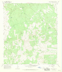
1967 Map of Howell Mountain
USGS Topo · Published 1969About this map
Walnut Hill Ch stands as a focal point in this 1967 study of the rugged Hill Country terrain along the Llano and Blanco County line. The landscape is defined by a series of prominent peaks and drainage systems, including Howell Mountain, Big Mountain, and Rattlesnake Mountain. The intricate network of waterways—such as West Walnut Creek, Pecan Creek, and North Cypress Creek—illustrates the natural erosion patterns that have shaped the numerous gaps and hollows here.
Find a feature on this map
26 named features on this map. Tap any name to fly to it.
Don’t see what you’re looking for? This feature index may not catch every label — zoom into the map to look around manually.
Map Details
Editions of this 1967 Howell Mountain Map
2 editions found
Other maps of this area

1887 · Llano
USGS Topo · 1:125,000

1887 · Blanco
USGS Topo · 1:125,000

1887 · Burnet
USGS Topo · 1:125,000

1893 · Burnet
USGS Topo · 1:125,000

1894 · Fredericksburg
USGS Topo · 1:125,000

1894 · Blanco
USGS Topo · 1:125,000

1894 · Llano
USGS Topo · 1:125,000

1903 · Burnet
USGS Topo · 1:125,000

1904 · Llano
USGS Topo · 1:125,000

1909 · Llano
USGS Topo · 1:125,000