
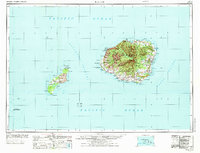
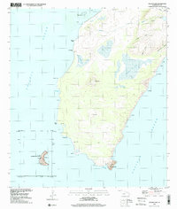
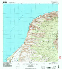
1970 Map of Kauai
USGS Topo · Published 1974This historical map portrays the area of Kauai in 1970, primarily covering Kauai County. Featuring a scale of 1:250000, this map provides a highly detailed snapshot of the terrain, roads, buildings, counties, and historical landmarks in the Kauai region at the time. Published in 1974, it is one of 2 known editions of this map due to revisions or reprints.
Find a feature on this map
122 named features on this map. Tap any name to fly to it.
Don’t see what you’re looking for? This feature index may not catch every label — zoom into the map to look around manually.
Map Details
Editions of this 1970 Kauai Map
2 editions found
Historical Maps of Numila Through Time
18 maps found

1954 Kauai
Kauai County, HI
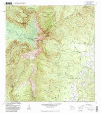
1965 Makaha Point
Kauai County, HI

1965 Waialeale
Kauai County, HI
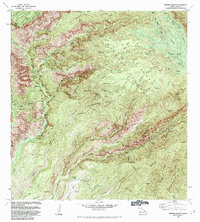
1965 Waimea Canyon
Kauai County, HI

1967 Kauai
Kauai County, HI
1970 Kauai
Kauai County, HI
1983 Makaha Point
Kauai County, HI
1983 Waialeale
Kauai County, HI
1983 Waimea Canyon
Kauai County, HI
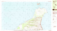
1984 Niihau North
Kauai County, HI
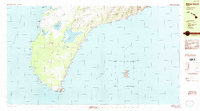
1984 Niihau South
Kauai County, HI
1989 Halalii Lake
Kauai County, HI
1989 Honuaula Valley
Kauai County, HI
1989 Kalanei
Kauai County, HI
1989 Keanauhi Valley
Kauai County, HI
1991 Makaha Point
Kauai County, HI
1991 Waialeale
Kauai County, HI
1991 Waimea Canyon
Kauai County, HI