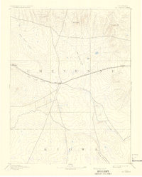
1893 Map of Kit Carson
USGS Topo · Published 1936About this map
Union Pacific Railroad tracks dominate the central corridor of this 1890 survey, marking the primary artery of travel across the High Plains of eastern Colorado. The settlement of Kit Carson serves as a focal point where multiple drainage systems converge, including the wide paths of Big Sandy Creek and Rush Creek. This landscape is defined by its intermittent watercourses and scattered high points like Twin Buttes and Landsman Hill, which provided essential navigation landmarks for early travelers and surveyors. Along the rail line, small outposts such as Wild Horse and First View illustrate the spaced settlement pattern typical of the era's steam-powered logistics. The map captures a moment before intensive irrigation, where the natural topography and the iron rail dictated the location of commerce and community near the border of Cheyenne and Kiowa counties.
Find a feature on this map
15 named features on this map. Tap any name to fly to it.
Don’t see what you’re looking for? This feature index may not catch every label — zoom into the map to look around manually.
Map Details
Editions of this 1893 Kit Carson Map
5 editions found
Other maps of this area

1890 · Granada
USGS Topo · 1:125,000

1891 · Arroyo
USGS Topo · 1:125,000

1891 · Kit Carson
USGS Topo · 1:125,000

1891 · Las Animas
USGS Topo · 1:125,000

1892 · Lamar
USGS Topo · 1:125,000

1892 · Cheyenne Wells
USGS Topo · 1:125,000

1892 · Granada
USGS Topo · 1:125,000

1893 · Arroyo
USGS Topo · 1:125,000

1893 · Kit Carson
USGS Topo · 1:125,000

1893 · Las Animas
USGS Topo · 1:125,000