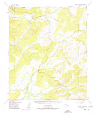
1954 Map of Livengood B-3
USGS Topo · Published 1977About this map
The Trans-Alaska Pipeline (Under Construction) cuts through this interior landscape, marking a transformative moment in Alaska's infrastructure development. Surveyed in the 1950s with 1970s revisions, the map highlights the rugged corridor along the Elliott Highway as it winds north toward the gold-producing regions. Evidence of earlier industrial activity remains visible in the tailings found near Amy Dome, where Ester Creek and Cleary Creek drain the high ground.
Find a feature on this map
20 named features on this map. Tap any name to fly to it.
Don’t see what you’re looking for? This feature index may not catch every label — zoom into the map to look around manually.
Map Details
Editions of this 1954 Livengood B-3 Map
4 editions found

Other maps of this area

1945 · Livengood
USGS Topo · 1:250,000

1951 · Livengood
USGS Topo · 1:250,000

1951 · Livengood C-2
USGS Topo · 1:63,360

1951 · Livengood B-2
USGS Topo · 1:63,360

1951 · Livengood A-4
USGS Topo · 1:63,360

1952 · Livengood C-4
USGS Topo · 1:63,360

1952 · Livengood A-2
USGS Topo · 1:63,360

1953 · Livengood B-4
USGS Topo · 1:63,360

1953 · Livengood A-4
USGS Topo · 1:63,360

1953 · Livengood A-3
USGS Topo · 1:63,360