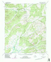
1954 Map of Livengood B-3
USGS Topo · Published 1985About this map
The Trans-Alaska Pipeline cuts through the interior wilderness on this 1954 survey, updated with 1975 revisions to document the massive energy infrastructure project during its building phase. This industrial corridor runs parallel to the Elliott Highway, passing through a landscape defined by the drainage basins of the Tolovana River and Tatalina River.
Find a feature on this map
21 named features on this map. Tap any name to fly to it.
Don’t see what you’re looking for? This feature index may not catch every label — zoom into the map to look around manually.
Map Details
Editions of this 1954 Livengood B-3 Map
4 editions found

Other maps of this area

1945 · Livengood
USGS Topo · 1:250,000

1951 · Livengood
USGS Topo · 1:250,000

1951 · Livengood C-2
USGS Topo · 1:63,360

1951 · Livengood B-2
USGS Topo · 1:63,360

1951 · Livengood A-4
USGS Topo · 1:63,360

1952 · Livengood C-4
USGS Topo · 1:63,360

1952 · Livengood A-2
USGS Topo · 1:63,360

1953 · Livengood B-4
USGS Topo · 1:63,360

1953 · Livengood A-4
USGS Topo · 1:63,360

1953 · Livengood A-3
USGS Topo · 1:63,360