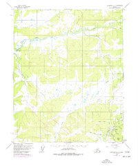
1952 Map of Livengood C-4
USGS Topo · Published 1977About this map
Livengood serves as the focal point for this Interior Alaska landscape, situated where the Elliott Highway meets a network of historic gold-bearing drainages. The map illustrates a significant era of transition as the massive project for the Trans-Alaska Pipeline is shown cutting across the northern and western sections of the territory. This infrastructure development overlays an older mining landscape, evidenced by the extensive tailings along Livengood Creek and the presence of a Landing Strip.
Find a feature on this map
23 named features on this map. Tap any name to fly to it.
Don’t see what you’re looking for? This feature index may not catch every label — zoom into the map to look around manually.
Map Details
Editions of this 1952 Livengood C-4 Map
4 editions found
Other maps of this area

1945 · Livengood
USGS Topo · 1:250,000

1951 · Livengood
USGS Topo · 1:250,000

1951 · Livengood D-3
USGS Topo · 1:63,360

1952 · Livengood C-5
USGS Topo · 1:63,360

1952 · Livengood B-5
USGS Topo · 1:63,360

1952 · Livengood D-5
USGS Topo · 1:63,360

1952 · Livengood C-4
USGS Topo · 1:63,360

1953 · Livengood B-4
USGS Topo · 1:63,360

1953 · Livengood D-4
USGS Topo · 1:63,360

1954 · Livengood B-3
USGS Topo · 1:63,360