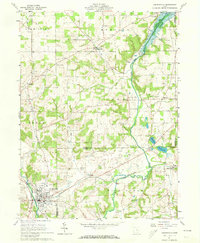
1961 Map of Loudonville
USGS Topo · Published 1973About this map
The Loudonville village center anchors this 1961 survey, situated at the confluence of the Black Fork Mohican River and Big Run. The map illustrates a diverse landscape where the rolling hills of north-central Ohio meet the industrialized corridors of the Pennsylvania railroad. Significant infrastructure for water management is evident at the Mohicanville Dam on the Lake Fork Mohican River, which regulates the flow through the Lake and Mohican townships.
Find a feature on this map
33 named features on this map. Tap any name to fly to it.
Don’t see what you’re looking for? This feature index may not catch every label — zoom into the map to look around manually.
Map Details
Editions of this 1961 Loudonville Map
3 editions found
Other maps of this area

1906 · West Salem
USGS Topo · 1:62,500

1908 · Ashland
USGS Topo · 1:62,500

1908 · West Salem
USGS Topo · 1:62,500

1912 · Loudonville
USGS Topo · 1:62,500

1912 · Perrysville
USGS Topo · 1:62,500

1914 · Loudonville
USGS Topo · 1:62,500

1915 · Perrysville
USGS Topo · 1:62,500

1943 · Loudonville
USGS Topo · 1:62,500

1944 · Perrysville
USGS Topo · 1:62,500

1950 · Marion
USGS Topo · 1:250,000