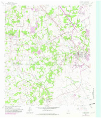
1959 Map of Mansfield
USGS Topo · Published 1982About this map
Mansfield sits at the junction of rail and road during a period of transition in North Texas. This 1959 survey, updated with revisions from 1979, highlights the shifting character of the Tarrant Co Johnson Co border as agricultural land began to make way for suburban growth. The presence of multiple educational landmarks like Nash Sch and Bludworth Sch, alongside the Walnut Creek Cem and Hudson Cem, provides a detailed record of the long-standing community centers in this region.
Find a feature on this map
40 named features on this map. Tap any name to fly to it.
Don’t see what you’re looking for? This feature index may not catch every label — zoom into the map to look around manually.
Map Details
Editions of this 1959 Mansfield Map
5 editions found

Other maps of this area

1891 · Cleburne
USGS Topo · 1:125,000

1894 · Cleburne
USGS Topo · 1:125,000

1894 · Fort Worth
USGS Topo · 1:125,000

1954 · Dallas
USGS Topo · 1:250,000

1955 · Burleson
USGS Topo · 1:24,000

1955 · Fort Worth
USGS Topo · 1:24,000

1958 · Dallas
USGS Topo · 1:250,000

1959 · Kennedale
USGS Topo · 1:24,000

1959 · Arlington
USGS Topo · 1:24,000

1959 · Britton
USGS Topo · 1:24,000