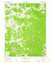
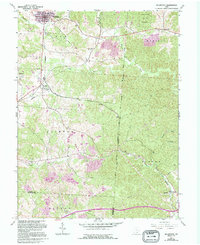
1961 Map of Mc Arthur
USGS Topo · Published 1963About this map
McArthur serves as the focal point of this early 1960s landscape, situated at the junction of the Baltimore and Ohio and Chesapeake and Ohio railroads. The era’s industrial character is clearly defined by numerous strip mines and quarries scattered throughout the townships of Elk, Madison, and Clinton. Public lands dominate the eastern and southern reaches, where the Wayne National Forest, Raccoon State Forest, and Zaleski State Forest converge. For family historians, the map records rural landmarks such as Vinton Chapel and Hilltop Ch, alongside several burial grounds like Hixon Cem and Beard Cem. The topography is marked by narrow valleys and ridges, including the site of the Oreton Lookout Tower and the small settlement of Puritan, which operated kilns near Sugar Run.
Find a feature on this map
43 named features on this map. Tap any name to fly to it.
Don’t see what you’re looking for? This feature index may not catch every label — zoom into the map to look around manually.
Map Details
Editions of this 1961 Mc Arthur Map
5 editions found
Other maps of this area

1904 · Zaleski
USGS Topo · 1:62,500

1905 · Wilkesville
USGS Topo · 1:62,500

1907 · Zaleski
USGS Topo · 1:62,500

1908 · Wilkesville
USGS Topo · 1:62,500

1910 · Laurelville
USGS Topo · 1:62,500

1912 · Laurelville
USGS Topo · 1:62,500

1913 · Jackson
USGS Topo · 1:62,500

1944 · Jackson
USGS Topo · 1:62,500

1944 · Laurelville
USGS Topo · 1:62,500

1947 · Columbus
USGS Topo · 1:250,000