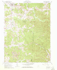
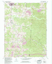
1961 Map of Mc Arthur
USGS Topo · Published 1972About this map
The town of McArthur serves as the focal point for this early 1960s study of Vinton County, where the converging tracks of the Baltimore and Ohio and Chesapeake and Ohio railroads anchor the local economy. The landscape is heavily defined by extraction and preservation, with numerous Strip Mines and Quarries carved into the hillsides alongside the expansive boundaries of the Wayne National Forest and Raccoon State Forest. Smaller settlements like Dundas, Puritan, and Oreton are scattered throughout the hollows, often near family-named landmarks like Hixon Cem and Boyd Cem. The presence of the Oreton Lookout Tower and remote structures like Vinton Chapel emphasize the deeply forested and rural nature of the terrain, while drainage systems like Puncheon Fork and Pierce Run cut through the dense ridges of Elk and Madison townships.
Find a feature on this map
41 named features on this map. Tap any name to fly to it.
Don’t see what you’re looking for? This feature index may not catch every label — zoom into the map to look around manually.
Map Details
Editions of this 1961 Mc Arthur Map
5 editions found
Other maps of this area

1904 · Zaleski
USGS Topo · 1:62,500

1905 · Wilkesville
USGS Topo · 1:62,500

1907 · Zaleski
USGS Topo · 1:62,500

1908 · Wilkesville
USGS Topo · 1:62,500

1910 · Laurelville
USGS Topo · 1:62,500

1912 · Laurelville
USGS Topo · 1:62,500

1913 · Jackson
USGS Topo · 1:62,500

1944 · Jackson
USGS Topo · 1:62,500

1944 · Laurelville
USGS Topo · 1:62,500

1947 · Columbus
USGS Topo · 1:250,000