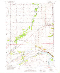
1954 Map of Minooka
USGS Topo · Published 1967About this map
Minooka serves as the primary hub in this mid-century portrait of the Grundy and Will County borderlands. The landscape is defined by the strategic confluence of the Illinois River, Des Plaines River, and Kankakee River, a waterway network vital to the region's transport history. The Michigan and Mississippi Canal remains a prominent feature, including the Aux Sable Lock and nearby Aux Sable Island.
Find a feature on this map
43 named features on this map. Tap any name to fly to it.
Don’t see what you’re looking for? This feature index may not catch every label — zoom into the map to look around manually.
Map Details
Editions of this 1954 Minooka Map
4 editions found
Other maps of this area

1892 · Morris
USGS Topo · 1:62,500

1892 · Joliet
USGS Topo · 1:62,500

1892 · Wilmington
USGS Topo · 1:62,500

1918 · Wilmington
USGS Topo · 1:62,500

1918 · Morris
USGS Topo · 1:62,500

1923 · Joliet
USGS Topo · 1:62,500

1925 · Yorkville
USGS Topo · 1:62,500

1953 · Morris
USGS Topo · 1:24,000

1953 · Plattville
USGS Topo · 1:24,000

1953 · Lisbon
USGS Topo · 1:24,000