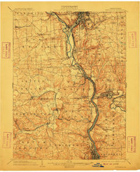
1904 Map of New Castle
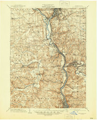
USGS Topo · Published 1939About this map
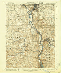
The industrial and transport corridors of Lawrence and Beaver Counties are anchored by the confluence of the Mahoning River and the Shenango River, forming the southward-flowing Beaver River. At the turn of the century, this region served as a critical node for heavy industry, with the Thompson Run Mines and numerous railroad junctions defining the local economy. A dense network of steel and coal arteries, including the Pittsburgh and Lake Erie RR and the Pennsylvania RR, connects established manufacturing hubs like New Castle and Ellwood City to smaller railway settlements such as Wampum, Mahoningtown, and Irish Ripple. Beyond the river valleys, the landscape transitions into the agricultural townships of North Beaver and Darlington, where rural life is shaped by tributaries like Hickory Run and Little Beaver Creek. This survey reveals the complex relationship between the natural topography and the intense rail infrastructure that powered Western Pennsylvania's development.
Find a feature on this map
84 named features on this map. Tap any name to fly to it.
Don’t see what you’re looking for? This feature index may not catch every label — zoom into the map to look around manually.
Map Details
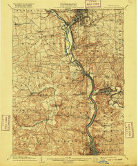
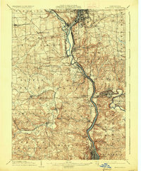
Editions of this 1904 New Castle Map
6 editions found