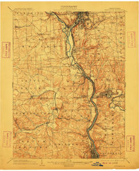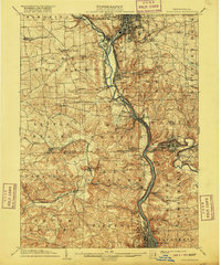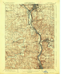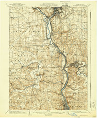
1904 Map of New Castle
USGS Topo · Published 1944About this map
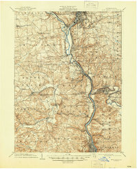
Industrial rail corridors and river valleys dominate this turn-of-the-century landscape at the confluence of the Mahoning River and the Shenango River. The city of New Castle serves as the primary hub, surrounded by a dense network of iron and coal infrastructure, including the Thompson Run Mines. The area's dependence on heavy transport is evident in the multiple competing rail lines, such as the Pittsburgh & Lake Erie R.R. and the Pittsburgh Fort Wayne and Chicago R.R., which thread through narrow river gaps to connect settlements like Mahoningtown and Wampum. To the south, Ellwood City sits along the Connoquenessing Creek, while small industrial hamlets like Irish Ripple Newport and West Pittsburg dot the banks of the Beaver River. The map captures the transition from steep, wooded ravines like Possum Hollow Run to the burgeoning manufacturing centers that defined the region’s early twentieth-century economy.
Find a feature on this map
89 named features on this map. Tap any name to fly to it.
Don’t see what you’re looking for? This feature index may not catch every label — zoom into the map to look around manually.
Map Details
Editions of this 1904 New Castle Map
6 editions found