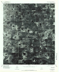
1976 Map of New Home NW
USGS Topo · Published 1984About this map
The High Plains landscape of the Texas Panhandle is captured in high-altitude detail in this orthophotograph, showcasing the geometry of agricultural production in the mid-1970s. The small community of Slide serves as the focal point of a vast grid of irrigation patterns and farm tracks, illustrating the intense land use common in this region of Lubbock County. Circular center-pivot irrigation patterns dominate the terrain, revealing the technological shift in water management that reshaped the local economy during this era.
Find a feature on this map
1 named feature on this map. Tap any name to fly to it.
Don’t see what you’re looking for? This feature index may not catch every label — zoom into the map to look around manually.
Map Details
Editions of this 1976 New Home NW Map
2 editions found

Other maps of this area

1954 · Lubbock
USGS Topo · 1:250,000

1954 · Brownfield
USGS Topo · 1:250,000

1957 · Lubbock East
USGS Topo · 1:24,000

1957 · New Home
USGS Topo · 1:62,500

1957 · Lubbock West
USGS Topo · 1:24,000

1957 · Lubbock
USGS Topo · 1:62,500

1957 · Meadow
USGS Topo · 1:62,500

1957 · Wolfforth
USGS Topo · 1:62,500

1958 · Brownfield
USGS Topo · 1:250,000

1962 · Brownfield
USGS Topo · 1:250,000