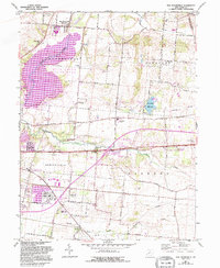
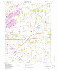
1961 Map of New Moorefield
USGS Topo · Published 1995About this map
Springfield and its eastern environs are captured during a period of transition, showing the city's growth alongside established rural townships like Moorefield and Pleasant. The expansion of the Clarence J Brown Reservoir and Buck Creek State Park has reshaped the valley of Buck Creek, while the historic National Road and the New York Central railroad corridor continue to anchor the region's transport network. Local social centers are well-defined, including the County Fairgrounds, the Drive-in Theater, and the Armory.
Find a feature on this map
66 named features on this map. Tap any name to fly to it.
Don’t see what you’re looking for? This feature index may not catch every label — zoom into the map to look around manually.
Map Details
Editions of this 1961 New Moorefield Map
5 editions found
Other maps of this area

1904 · Springfield
USGS Topo · 1:62,500

1906 · Springfield
USGS Topo · 1:62,500

1907 · South Charleston
USGS Topo · 1:62,500

1914 · St. Paris
USGS Topo · 1:62,500

1914 · Mechanicsburg
USGS Topo · 1:62,500

1916 · Mechanicsburg
USGS Topo · 1:62,500

1916 · St. Paris
USGS Topo · 1:62,500

1944 · Mechanicsburg
USGS Topo · 1:62,500

1944 · St. Paris
USGS Topo · 1:62,500

1947 · Columbus
USGS Topo · 1:250,000