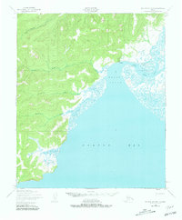
1950 Map of Norton Bay D-5
USGS Topo · Published 1981About this map
Koyuk sits at the northern terminus of the Koyuk Inlet, serving as a vital focal point where the Koyuk River meets the expansive Norton Bay. This 1950 coastal survey, based on photogrammetric methods from aerial photographs, illustrates a landscape defined by intricate tidal flats and winding river systems. The map captures the remote infrastructure of the era, including a Landing Strip and an additional approximate location for a second strip near the settlement, reflecting the area's reliance on air and water transport. To the west, several named waterways such as the Mukluktulik River, Miniatulik River, and Kuiuktulik River drain from the interior highlands toward the coast. The absence of roads and the dominance of marshy terrain along Kenwood Creek highlight the seasonal and environmental challenges faced by those inhabiting this section of the Seward Peninsula.
Find a feature on this map
10 named features on this map. Tap any name to fly to it.
Don’t see what you’re looking for? This feature index may not catch every label — zoom into the map to look around manually.
Map Details
Editions of this 1950 Norton Bay D-5 Map
3 editions found
Other maps of this area

1948 · Norton Bay
USGS Topo · 1:250,000

1950 · Norton Bay D-6
USGS Topo · 1:63,360

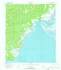
1950 · Norton Bay D-5
USGS Topo · 1:63,360

1950 · Norton Bay C-6
USGS Topo · 1:63,360

1950 · Candle A-6
USGS Topo · 1:63,360

1950 · Candle A-5
USGS Topo · 1:63,360

1950 · Norton Bay D-4
USGS Topo · 1:63,360

1950 · Norton Bay C-5
USGS Topo · 1:63,360

1950 · Norton Bay C-4
USGS Topo · 1:63,360

1951 · Candle
USGS Topo · 1:250,000