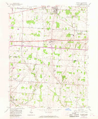
1958 Map of Pataskala
USGS Topo · Published 1968About this map
The South Fork Licking River winds through the northern portion of this landscape, anchoring the village of Pataskala as a central hub for transportation and commerce. Established rail lines including the Baltimore and Ohio and Penn Central emphasize the region's historical role in moving goods across central Ohio. To the south, the village of Pickerington and the crossroads at Etna along the National Road illustrate the shift from early turnpike travel to modern highway infrastructure.
Find a feature on this map
35 named features on this map. Tap any name to fly to it.
Don’t see what you’re looking for? This feature index may not catch every label — zoom into the map to look around manually.
Map Details
Editions of this 1958 Pataskala Map
4 editions found
Other maps of this area

1902 · Westerville
USGS Topo · 1:62,500

1904 · Westerville
USGS Topo · 1:62,500

1907 · Thurston
USGS Topo · 1:62,500

1908 · Granville
USGS Topo · 1:62,500

1909 · Thurston
USGS Topo · 1:62,500

1910 · Granville
USGS Topo · 1:62,500

1925 · East Columbus
USGS Topo · 1:62,500

1943 · East Columbus
USGS Topo · 1:62,500

1947 · Columbus
USGS Topo · 1:250,000

1950 · Marion
USGS Topo · 1:250,000